|
Penang Hills and Trails - Carla's Peak Part 5 |
|||||||||||||||||||||||||||||||||||||||||||||||||||
|
This is part of a series of pages on walking the hills of Penang. Click here for the index. This is a tough Grade 4 walk owing to the steepness in parts particularly in the abandoned terraces of the development. There is a sketch map at the bottom showing the route followed. Click here for a list of the known PBA rain gauges. Please visit my Penang buses page for information on accessing the starting point. This report updates and replaces an earlier one posted several years ago. There are three other reports of visits made to this area about the same time which are worth reading to get a proper picture: The previous walks had been done over the Christmas and New Year holidays to avoid the inevitable traffic chaos. Now it was Chinese New Year and leaving Mavis at home seemed a very good idea. I have subsequently added a note on the connection between the two summits at the north end of Carla's Peak. The previous day, we had started behind our home in Mount Pleasure, gone up Carla's Peak and ended up in the Sungai Emas housing development in Batu Ferringhi. It had been made longer by following hash paper that was obviously intent on going back over the hill on what, in theory, should have been a slightly more direct route. Today was all about following that apparently direct route. We started at the top of Jalan Sungai Emas 3 on the steps we had previously come down.
Necessarily, 24 hours later, there were no surprises except the complete absence of fellow walkers as it was a Sunday, albeit in the middle of the day.
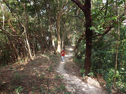
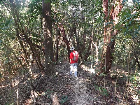
We had our first water stop at the rest area and continued.
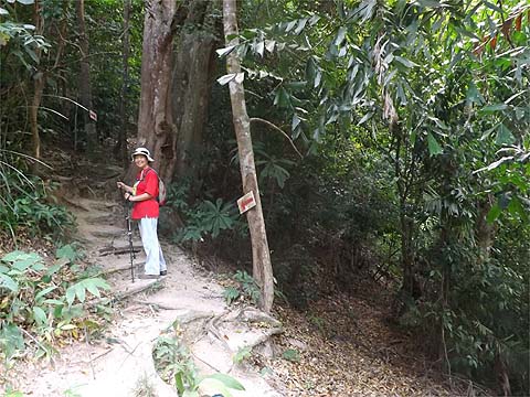
At the point where the climb gets steep again, Yuehong went left and I continued straight ahead to check out the path with the water pipes. It was a bit rough in places but perfectly viable.
It was not as well used as the main path but with the water pipes as (near) companions it would have been hard to get lost.
Eventually the pipe ducked under a fallen tree, I followed and I was back at the stream where we had crossed it the day before. So all I had to do was retrace our steps upwards to the left.
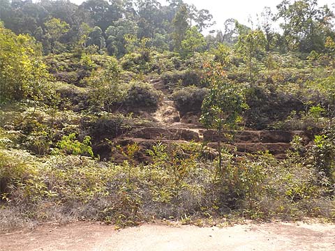
When I rejoined Yuehong at the rest area, I was informed that she'd been there for 15 minutes which was roughly equivalent to the time I had spent following the water pipe. We headed on into the cleared area behind...Whoever was responsible for this desecration should have been nailed to the ground in the middle of it in the noon day sun. I don't know when it was done, but it was like this on my previous visit 5 years earlier - it's clearly visible in Google Maps Satellite View.
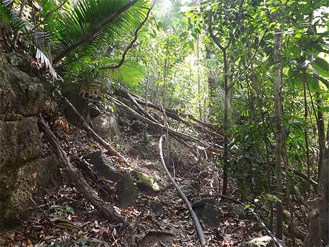
The lower area consists of wide terraces separated by banks of about 5 metres and the only way between them is courtesy of ropes installed by other hikers or hashers (in theory there should be a better graded route at the ends). The only cover are ferns and a few pitcher plants, whoever removed the top soil did a thorough job. Further up, there are ledges and it was easier to climb between them. We followed the paper round to the right and up and were rewarded with the only view of the day. Fortunately, it was hazy, Batu Ferringhi is not my destination of choice on Penang.
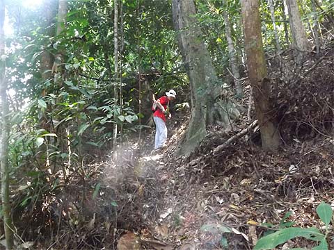
It had taken us 30 minutes from the rest area before we entered the forest. There was no problem here to follow the hash paper which would be our companion for the rest of the hike.
It was not a difficult climb and in 20 minutes we were on a flat path which led to the highest point we got to. Now I had expected to be able to visit the summit we had been to the day before by climbing from our home but that was not to be - looking at my maps later we should have been quite close as they show two northern summits in close proximity (as opposed to the southern summit which is some distance away). However, I failed to spot a connecting path - I think it should have carried the recent Harriets' paper and then two (!) hash paper trails separately continued left and downwards. This area is hashed intensively and at times it seemed we were seamlessly transitioning from one set of paper to another although, in fact, it's probably down to a 'path' having paper from several different events
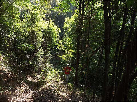
We chose the second as being more likely to lead 'home' and started down along a fallen tree. Very soon it got rather steeper.
The two sets of paper recombined and instead of heading directly down we started a long traverse. Some of our worst experiences have been on routes that go down and across, not surprisingly as it's difficult enough to trying to follow ridges down. While there was paper all the way, at times we had to stop and look around because it looked suspiciously like a GPS inspired route with wriggles to avoid the worst bits encountered. We were very much going 'against the grain' and the paper was mostly attached to the wrong side of the trees as far as we were concerned.
We had no real choice but to follow it, but we're too old to find this sort of thing 'fun'. At one stage, Yuehong misjudged a slope and ended up stuck horizontal with a leg trapped by a vine which I had to cut through.
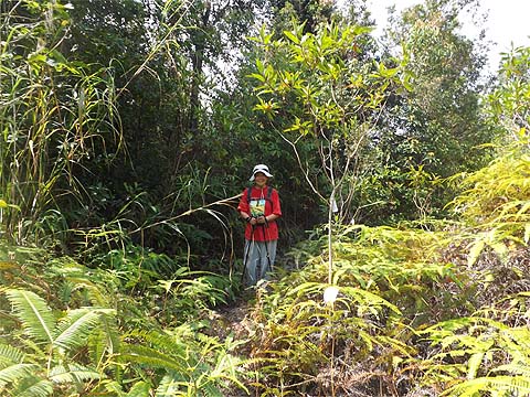
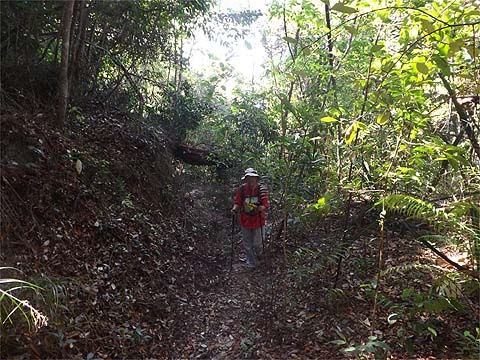
Eventually, as expected, we left the original forest and entered old rubber. That meant more open countryside but at the cost of having to scramble between the terraces.
The paper again divided, given our preferred destination (home!) we chose right even if it meant climbing slightly. Suddenly we were back on a real path again, it was most welcome as Yuehong was approaching exhaustion and I was rather dehydrated having wisely decided to postpone my regular Tigers so as to keep a clear head.
Round the corner we found ourselves on the main trail up and, glory be, we were only a couple of minutes from where we could cut left towards home.
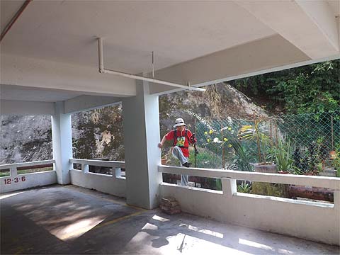
It was a welcome sight, we slipped down the slope and into the back of the car park.
It had not been a great experience and we'll not be returning in a hurry. I am a little curious as to what exactly happens at the top, there should be a connection as we had seen paper in the right direction the previous day. I don't think Yuehong shares that curiosity though - I will have to that a quick solo bash on a family rest day. The only other unanswered question is whether it had been really necessary to leave the ridge the previous day and scramble down to the stream and that also is likely to remain that way until I get totally bored with our normal hiking - that would mean going up from the Sungai Emas housing to the stream and up the rough climb to it. Carla's Peak Extra. It turns out that there are two summits at the north end of Carla's Peak. We had visited the northern one, previously we had visited the southern one. A few days later with a free afternoon I investigated the connection between them. It's not surprising that we failed to spot the required junction, it's less than obvious and the hares laying the paper we followed had quite sensibly removed the existing paper in that area. Basically, you need to turn right about one minute before the path described above starts to descend steeply. At the moment it's recognisable by the three rotten logs. The path is not obvious but most likely there will be some hash paper visible.
Avoid descending excessively keeping the ferns on your left at the open area which is the col. Go ahead up along the edge of the ferns.
When you meet ferns on the right go into the gap between the two patches. Very soon you will come to a junction.
The path to the left leads down to Shamrock Bay (a very pleasant descent, much better than that described on this page), that on the right leads to the southern summit of Carla's peak from where you can go left for Tanjung Bunga or right for Batu Ferringhi.
|