|
Penang Hills and Trails - Carla's Peak Part 4 |
|||||||||||||||||||||||||||||||||||||||||||||||||||||||
|
This is part of a series of pages on walking the hills of Penang. Click here for the index. This is a tough Grade 3 walk owing to the steepness in parts. There is a sketch map at the bottom showing the route followed. Click here for a list of the known PBA rain gauges. Please visit my Penang buses page for information on accessing the starting point. This report updates and replaces an earlier one posted several years ago. There are three other reports of visits made to this area about the same time which are worth reading to get a proper picture: The previous walks had been done over the Christmas and New Year holidays to avoid the inevitable traffic chaos. Now it was Chinese New Year and leaving Mavis at home seemed a very good idea. I have subsequently added a note on the connection between the two summits at the north end of Carla's Peak. This hike officially starts in Jalan Pantai Batu above 'Shamrock Bay' behind the small Tua Pek Kong temple some way up. If you go in here you will find a wide track which leads up and joins the route described below. Since we live in Seaview Garden not far away we have a back door into the trail, this route is NOT available to the general public and it's a stiff climb up to join the path.
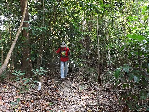
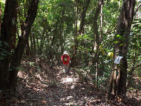
However, the initial climb onwards is quite gentle. We had a new hare and the most recent hash paper appeared to be from the Harriets following hard on the heels of the International Hash Hounds.
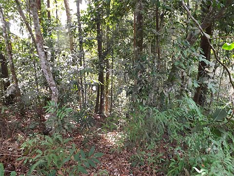
Climbing up, we were left with the impression that a little less paper would have been no bad thing, it was almost impossible to take a picture without including some. We saw both dusky leaf monkeys and a giant black squirrel, perhaps they might like to eat some of it?
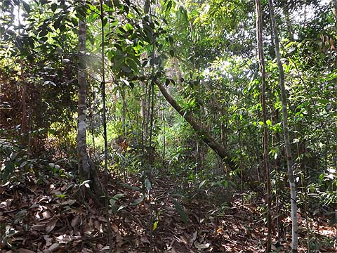
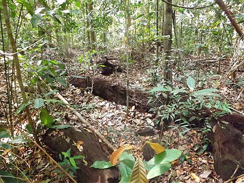
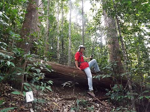
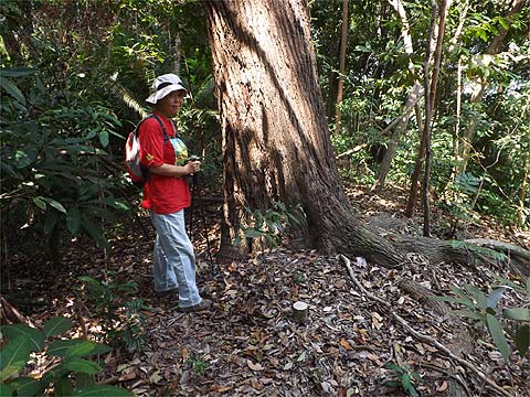
The upper section above the rubber terraces is more interesting. There are some marvellous trees, this one was horizontal...
...but this was still standing proud. In just over an hour we were at the first summit. I had an open mind as to what we would do next, possibly we might follow the hash paper down to the right but I had been down that way before and I ended up in a failed development with steep terraces. Information on that right turn is given at the bottom of the page.
In any case, I first wanted to see if I could find again the remains of the rain gauge in the ferns at the other summit and that meant a very pleasant 20 minutes walking along the ridge between them.
When we arrived, I wasted 15 minutes trying and failing to find the rain gauge remains I had discovered 5 years earlier, it should have been in the ferns but despite much trampling and cutting back it eluded me. My notes said that there was no proper path to the right, but there was fresh paper from my old hash and that was hard if not impossible to resist.
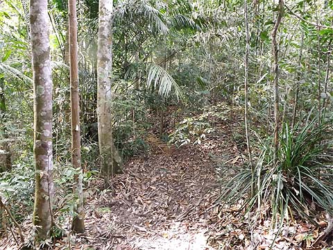
It was indeed a path and it wiggled a bit before straightening up and going down what was clearly a ridge.
It was no racing track but it was more than acceptable. After a while it entered a narrow flat section and we could hear water below us on the right although it seemed to covered by large boulders.
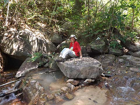
It seemed a good time to take a break, Yuehong hit the water melon and I opened a Tiger. It was probably a little premature as it turned out. When we continued, we passed a reassuring boundary marker on the ground.
Then I realised that I was 'off paper' as I continued down the ridge. Yuehong called me back and pointed that it had turned right and went down. This was rather counter-intuitive but given we were on completely new territory we didn't have a great deal of choice but to follow it.
It was more than steep, especially as there seems to have been a landslide here not so long ago, perhaps there was a path there. I left Yuehong to go at her safety first speed and headed down to the stream. I had a rather longer wait than I expected but it had only taken us 90 minutes to get down.
She had taken a bit of a tumble on the sand and slid down flat on her front (not here which would have been disastrous but before). The stream gave her an opportunity to get a clean up. I did a recce ahead and when I got back she was all smiles again.
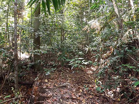
I do not like following stream beds and the water pipes here disappeared under some fallen trees below so I felt we had no real choice but to stick with the paper. (As I discovered next day, there is indeed a path along the pipes, it's perfectly manageable and the blockage an illusion.) We went back into the forest and started to climb, this was no path any longer!
Quite soon it improved back to path status but definitely we were going up and not even following a contour, let alone down. From our previous experience with hash paper in this area it dawned on me that most likely it would head back up the hill to where we had been earlier. We'd had a long hike the previous day and I don't think either of us really fancied that although there was plenty of time (and water) if necessary. From what we found the next day, it was an extremely wise decision.
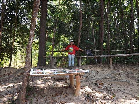
We came to a roped section - never a good sign - and then suddenly we were in one of those rest areas that appear in all sorts of strange places on the island. I did another recce and found we were on the edge of the large cleared, terraced area I had visited long ago. The most recent paper obviously continued upwards and there was old paper too to the left of it (and presumably down towards the Moonlight Bay area).
However, there was a third option, a path sharp down to the left which was clearly well used and this seemed the safest bet for an early shower. Again there was a rope to start with..
... then I noticed there were steps on the left too. It was probably the least demanding slope we had seen today.
There were more steps (in fact lots of them) and we emerged to a wider path. Somewhat reassuringly, the last couple of steps were the water pipes we had seen earlier and there looked to be the remains at least of a path beside them but I wasn't going to check that today (next day I checked it and indeed it leads to the stream we crossed earlier). It was definitely time for another refreshment break!
We now had a relatively flat section, we saw another large dusky leaf monkey with a long tail climbing a tree to get away from us and we came to a second rest area.
From time to time we could look out and it seemed we were still some way above the east end of Batu Ferringhi but the steps were easy to negotiate.
Finally we emerged at what turned out to be the top of the Sungai Emas housing development, that was probably another 90 minutes from the stream crossing but we had been taking it very easily. While the roads had been put in and named, it seemed the money (and customers) had run out and there were many empty plots. We were told to keep turning right and as we did we came to some rather nice houses, not all of which seemed to have been sold. We concluded that the location was not all it might have been for what was on offer. Batu Ferringhi means lots of hotels and restaurants and it gets very crowded with tourists at certain times of the year. What it doesn't have are the kind of things the affluent middle class might desire, a nice view, good schools and most of all quality shopping. We would never dream of living here, Batu Ferringhi appears in our postal address but our pad is several kilometres away and up a hill surrounded by trees and with a view to die for.
Of course, by the time we had walked down to the Golden Sands area, we were hot and sticky. The congested traffic coming from town had screwed up the buses so the day trippers were twiddling their thumbs in large numbers. Yuehong said "Taxi?" and two minutes later we had invested the price of a bottle of Tiger to get us home in 10 minutes. Our driver would probably have needed 40 minutes to get back, not that it mattered to him as there were at least half a dozen other taxis sitting idle at the taxi stand. It had been a fascinating hike, quite a few unexpected questions had been answered but there was obviously scope for further exploration, particularly in regard to the first ridge we came down and the area above the first rest point.. The next day we returned on a hike which answered most but by no means all of them, but the route followed was far less comfortable. Carla's Peak Extra. One of the options we had considered was to turn right at the northern summit of Carla's Peak. It turns out that there are two peaks here, separated by a small dip. To get to the other (northern) one, turn right along the edge of the ferns at the summit, continue and start descending slightly with more ferns on your right.
The slope soon eases and the col is quite open.
The nondescript path starts to rise and just beyond the three rotten logs is another path - there is no obvious junction as such. Turn right for an alternative descent to Shamrock Bay (not one of Penang's great experiences) or turn left to go to the Sungai Emas housing development in Batu Ferringhi (another experience probably best avoided). For detail see this hike.
|


 '
'