|
Penang Hills and Trails - National Park Sanity, 2020 |
|||||||||||||||||||||||||||||||||||||||
|
This is part of a series of pages on walking the hills of Penang. Click here for the index. This is a Grade 4 walk. There is a sketch map at the bottom showing the route followed. Please visit my Penang buses page for information on accessing the starting point. 5 days earlier with friends Rexy and Peter, we had climbed Bukit Telaga Batu in Penang's National Park and chosen a route down which in hindsight I would consider as some kind of madness. Today we would turn right instead of left at the top of the hill, something which I described in that report as "the easy thing would have been to turn right and head down to Tanjung Duyong, a path that is marked on more than one old map and still seemed to be present". Easier it certainly was but that only in comparison. As you will read, this time the Gods smiled on us as the route we followed had in part been cut back and trees (re)marked. If you were that local hero and read this, please get in touch so we can thank you properly. First though we had to climb Bukit Telaga Batu. Now that is straightforward, and I didn't bother to record it again. You can read about it here and there's a link back to this page at the appropriate point. First though note that if you want to go down towards the Pantai Keracut path, then the junction may not be obvious although it does come at a point where the ridge changes direction. The first picture shows Yuehong arriving at this point from below and the second resting before the next section. Necessarily those dead trunks will rot away over time.
Along the ridge the path is well defined and we noted the first of many helpful triple notches on trees. In the sort of area we were heading into, I would rate them far more useful than a GPS device which knows nothing about blockages. The ridge must be quite narrow and exposed at this point as there are few larger trees.
As you can see, the camera struggled with 'light and shade' under the harsh sun. However, just occasionally things came together to give a striking image as Yuehong walked through the 'Bertam' palms They are not my favourite jungle plants but at least it's usually possible to find a way through them.
We started down and soon reached the first blockage. As I recall we had to first go right and then go left and in the middle we found this former beetle's exoskelton.
For the time being the route probably qualified as a 'path' and it would have been easy to be lulled into a false sense of security, certainly it was much easier going than the previous descent from Bukit Telaga Batu.
The smug feeling was reinforced when we came to this yellow marker which had been placed by USM staff as part of their research which saw a number of trees bearing labels, presumably so their progress could be logged during occasional survey visits.
So, I said to myself, "If USM staff come here on a regular basis, we can expect a well used path on down from here". How stupid can you get? We were entering the coastal forest and we should have remembered what that is like from our last descent just a couple of kilometres away to the north.
It was about now that we realised that relying entirely on our experience and intuition wasn't going to get us to the bottom any time in the near future. As I said, the GPS is useless in this kind of forest and it was indeed fortunate that very recently the triple notch marks on the trees had been 'refreshed'. Sometimes you could detect where the 'saint' had passed, most of the time we just kept following the trail of notches.
We were now firmly into 'the prickles'. When we came to this big tree, we went to the left which is where the roots were and again we found notches.
The picture on the left shows some older notches and for anyone coming up, there were usually more notches on the other side. Just how lucky we had been was clearly demonstrated when we came upon freshly cut fronds. Some were brown and had probably already died back but others were still distinctly green.
Now in such circumstances, when you come to an open area, if you can't see notches ahead, then one of you stands at the last one while the other scouts left and right. It wasn't somewhere you could just walk in a straight line and the tactic worked every time. For some time we had heard the waves breaking on the rocks some way below us but then we could see a bright patch immediately ahead.
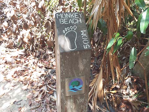
We were 'out' and at one of the most anonymous junctions I have ever experienced in Penang. It is at what is proabably the summit of the coastal path between Teluk Aling and Teluk Duyong (Monkey Beach). Ahead and below would have been Tanjung Duyong.
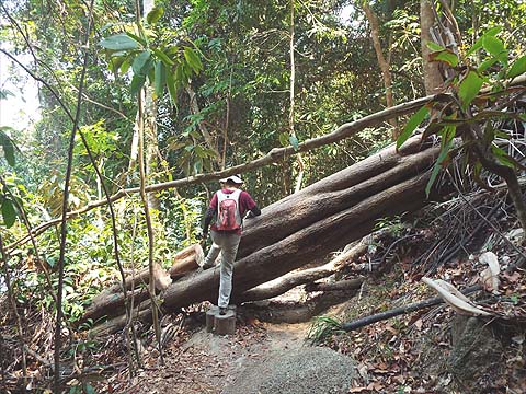
Fortunately just here, without realising it, the park authorities have added a 'marker' of their own. Now last time we had 'cheated' by taking a boat back from Monkey Beach so we felt we needed to check out the path there. This part of the path has been officially closed on safety grounds for some time and we were interested to see just why, after all compared to what we had come through it could hardly be a problem? First up there was a simple 'tree down'.
Now if you are one of those people who think that not only is the National Park totally wonderful (I agree) but the staff are doing a great job maintaining its infrastructure, then I suggest you 'look away now'. Quite simply, as the pictures show, it's a disgrace, those in charge of it should hang their heads in shame. The State Forestry Department pioneered the biodegradable viewing platform, now the National Park has perfected the biodegradable bridge (to add to their earlier self destructing concrete path). From what I have read, it seems they were put in 'on the cheap' when the Forest Reserve was upgraded and haven't been touched since. Monkey Beach looks great in pictures like this but the area behind the beach is an awful advertisement for the Park, although to be fair it is actually still in private hands and there is nothing much that can be done about it.
Why pay to go to 'Escape' when you can have the thrill of walking on the loose slats on this bridge for free? In a remarkable show of intelligence, a 'step' had been cut out of this tree, I doubt the kind person who did it works for the National Park.
At some stage concrete steps and walkways were added. Now the steel banisters are rusting in the salty atmosphere and trees have destroyed some too.
When we got to Teluk Aling, there was much less litter as this is where USM's CEMACS (Centre for Marine and Coastal Studies) has a research station and accommodation for students on field trips. There is also a jetty for people to come and go in boats from Teluk Bahang and critically there is mains electricity too which will make conditions pretty comfortable compared to the camping which some park visitors 'enjoy'.
Several times we crossed other hikers and twice this flushed out water monitors which are common here. There was a fair amount of 'up and down' and just occasionally a relaxing stretch of flat hiking.
This section is still officially open but is still not 100% safe, this steel platform between the two sets of steps has rusted through completely in two places. Finally, where we joined the Pantai Keracut path this wooden building has come to the end of it useful life.
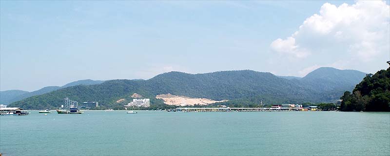
We had a fine view across to the ridge leading up to Bukit Laksamana with Western Hill behind. The white building is the closed Hotel Mutiara and the scar on the hillside is a quarry whose illegal operation the city council (MBPP) has chosen to ignore. From here to the gate there are several notices warning that the park is a 'No Smoking' zone but this went straight over the head of one of the sweepers who was puffing as he worked right next to one of them.
It's difficult to avoid concluding that too much money is being spent on creating 'non-jobs' and almost none on maintenance. Certainly I have seen very little evidence of improvements since we started hiking here with the possible exception of parts of the Bukit Batu Itam trail. Quite simply, the National Park gets better and better the further you get from the HQ at the entrance and those places where the tourists congregate. Increasingly they will go to one of the beaches by boat and this means they will leave totally unexposed to the rain forest interior. No wonder the discerning visitor is likely to enter by one of the unguarded entrances which access nearly all the best trails.
|