|
Penang Hills and Trails - Mon Sejour |
|||||||||||||||||||||||||||||||||||||||
|
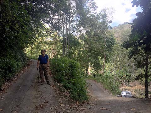
This is one of a series of pages on walking the hills of Penang, click here for the index. This is a Grade 3 walk. There is a sketch map at the bottom showing the route followed. Click here for a list of the known PBA rain gauges. Please visit my Penang buses page for information on accessing the starting point. This was another 'Wednesday Walk' on the east side of the island when we don't dine in Sungai Pinang. It wasn't any old Wednesday, it was Christmas Day when the wisest thing used to be to climb Carla's Peak behind our flat but Yuehong would veto that these days as her knee would be wrecked by any of the available descents. Instead, we accepted the 'hit' of driving straight through Air Itam to the dam to revisit an area we have not been to for some 7 years, which tells you immediately that it is not one of our favourites. The lesson of today was how much things can change over time... I've not given much detail for the better known routes later on, but have added appropriate links. We headed straight across the dam wall and went slightly right and continued on the wide path till we came to the road up from Air Itam. At the Rain Gauge 28 junction (RG 28) we found a PBA pick up with its driver waiting for the return of the crew reading it. Most of us would think that one man on a motorbike would be sufficient, but maybe the short ascent has been deemed a sufficiently high risk task to require more people. We continued to the point where the road divides in three. It looked much as before.
We went left and climbed to the house where previously we had found a nice locally made rubber roller. Somebody had removed it, most likely as a souvenir, such things have little scrap value. Never mind, we had already found four more 'new' ones on the way up.
As before we continued along the contour path behind until we came to where we had climbed before (left picture), This must have been one of the many illegally cut places in the Bukit Kerajaan Forest Reserve and unlike nearly all of them, this one had been subject of an attempted restoration. Now getting a contractor to plant some suitable small trees sounds like a good idea. Abandoning them and letting nature takes its course, probably less so. I know that is not what they do in the durian orchards!
Nothing was going to get me to climb some 200 metres through the crap to the forest where the path was last time so back we went. We now had time to spare and so we checked out this other way up near the 3 way junction. It went quite a way up into a cleared area which was probably also part of the reserve. Not much work had been done here recently and eventually the concrete path faded away. With Moniot Road still well above us, that was a challenge I could do without. Now at the junction we took the middle way and followed the concrete path towards the Buddhist Centre, we would attempt to find the path which 7 years earlier had led to the Brothers Bungalow. We came to a junction where the signs suggested other like minded people had been here too.
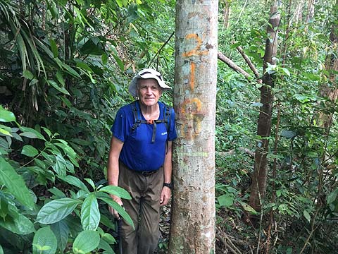
I confess I hadn't done my homework and was very rusty on what should be done. This part of the centre has been abandoned and we wasted a little bit of time before we decided it was necessary to climb the steps beside where we found these two Ultimate Trails of Penang 2019 markers. We'd seen their small grey survey markers on the road up and it was now obvious that 'all' we needed to do was identify their route. The picture on the right below shows the top of the steps in 2012, apart from the people it still looked much the same.
We turned right and followed the concrete path to the end - these are 2012 pictures.
Things had changed a little, no wonder there was no recognition on my part. There's also a small stupa now. Most importantly, there were grey survey markers going up.
Now compared to elsewhere we have been (Pantai Acheh and Bukit Batu Itam) the organisers had made a fair job of tidying up. This is old rubber and they would have taken a terrace on the right but which one? Eventually, I decided it would be a good ides to follow the hi tech overhead electricity line Bingo! There's one of the markers that got missed.
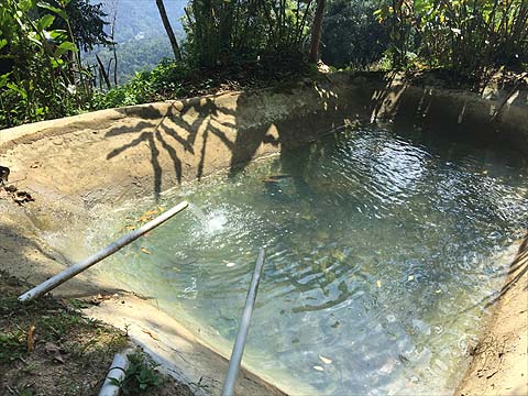
The organisers had laid on a mid run bath and beyond we were into old rubber with a fair trail and a number of signs which looked as if they went back a while.
We came to a fallen tree and the 'power lines' went up to the left while the trail kept roughly level.
At one stage, I thought I was going to be invited into a 'cave' but we passed the boulders and knew we were approaching 'civilisation' when we passed a fridge which had been pushed over the edge of the hill.
There was more to come with a TV and cooking utensils, but we were now on a concrete path which led up to 'Mon Sejour'.
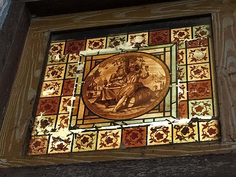
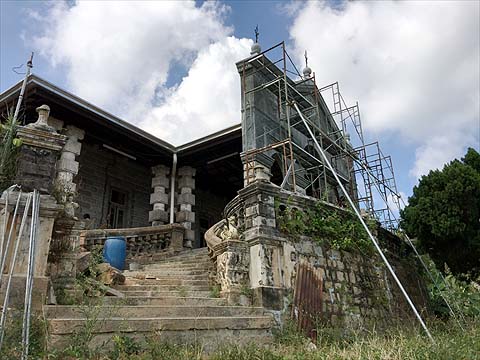
This is a bungalow for which the phrase 'faded glory' might have been invented. It's under long term low budget restoration and sensibly the roof has been sorted first, the interior ceiling can wait. Some elements of the interior remain but most of the windows and furniture are gone.
This is the current owner who lives here and the pictures are of his family. In the kitchen is a huge cooking range made by MacDowall Steven who were famous for this and other cast iron items such as fountains, band stands and pillar boxes. Check out their entry in Graces Guide.
The bungalow has an ornate facade which is best photographed with a drone in the early morning! This picture definitely does not begin to do it justice. On the way out we spotted this set of wheels which must have come from the goods wagon which went on the upper side of the passenger coach on the first and second generation trains of the Penang Hill Railway. Note one wheel with a double flange and one without, an arrangement which ensured the train always went to the same side at the crossing points.
I regretted leaving my camera at home, Yuehong's smartphone is fine for 'normal' light but not really fit for purpose in poor lighting and it's a drudge getting it out from the bag each time and the results often need phtotshopping. By now we had managed to 'waste' rather more time than was perhaps advisable and I called it a day for photography. The map below shows our route back. Just up from 'Mon Sejour' is the Moniot Road and we had come along it with Mike Gibby a while back. The first part of the descent is described in it. If you read that account you will find where we turned left for the Middle Station, but this time we turned right which would take us down towards Air Itam - this is described here. Very soon after we turned right for the dam, a route which we have followed several times but which I haven't ever got round to writing up properly. It's quite straight forward except that about half way along the level stretch, the desired path branches left - right just goes up only to a flower farm. Unfortunately, there have been a couple of landslides here which has scared some hikers away but it's by no means impossible. It was a beautiful evening back at the dam and there was a reminder that the early dry season has left the Teluk Bahang Dam well down. Fortunately, I believe the upgrade at the much larger dam at Mengkuang on the mainland is effectively finished and it will be stocked from the Muda River which runs along the border with Kedah.
Our regular coffee shop in Air Itam was already closed so we headed straight for our version of Christmas dinner. We were rather tired and the next day we did a very short hike indeed.
|