|
Penang Hills and Trails - Tiger Hill Ridge
Circuit |
|||||||||||||||||||||||||||||||||||||||||||||||||||||||||||||||
|
This is one of a series of pages on walking the hills of Penang, click here for the index. This is a long(ish) Grade 3 walk. There is a sketch map at the bottom showing the route followed. Click here for a list of the known PBA rain gauges. Please visit my Penang buses page for information on accessing the starting point. We're winding down before returning to the UK, carefully managing our time and making sure we get enough rest between 'serious hikes'. Today was planned as a long but not too demanding walk to keep us in peak condition. In fact, we haven't got to the Air Itam Dam too often in recent years, especially as it had been inaccessible by road until December 2018 after the great storm of November 2017. So it was actually 3 years since we last did the first part of the walk, during which time Yuehong's fitness has improved out of all recognition such that the whole walk was 'total joy'. One of the main reasons for choosing this route was that March, as usual, has been 'very warm' and hiking in the rain forest canopy well above sea level is the best way to avoid overheating. The PBA seems to be taking advantage of the usual low water conditions at this time of year to do some essential repairs and I am sure they have allowed the water level to drop so they can better access the area, the boom was doing a fair job in keeping back any run off, it having rained quite recently. We walked across the dam and up the side of the work area to join the wide path out to the right.
It's a good way to warm up, it follows the contours and there's one junction where we kept left. Soon we reached the concrete road that comes up from the Buddhist temple by Kek Lok Si, "KWARN INN SAHN POW YIN SIAN TSI(P)" - if you don't have a car this is the way to join the walk.
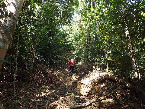
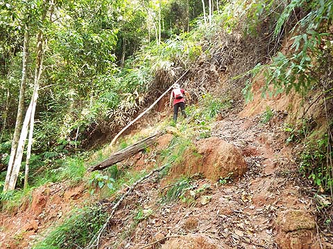
It's not very far up to the start of the main climb, it's behind Yuehong opposite this distinctive junction and the short, first part is very steep.
There is (was) a short cut from part way up the concrete road to where rain gauge 28 (RG 28) has been relocated but it seems to be rather overgrown. The initial part of the climb is through former rubber but apart from the outlines of terraces there is no real indication of this.
One terrace is rather clearer than most and this is the former location of RG 28 as evidenced by the 2016 picture on the right - note the two larger trees with the thinner one behind.
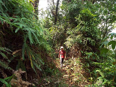
Above the rubber, the 'forest' was clear as quite a few trees had come down.
It was a relief to get back under the canopy and we could see that we were back in the 'rubber'.
Again, as the rubber finished we entered an area of carnage. the hill behind our condo is similar above the transition and I don't think this is just a coincidence.
Never mind, as we continued to climb we seemed to be in original rain forest.
The last time we saw 'F3' was on the descent to Pantai Mas, I assume they are some kind of hiking group. By now we were about half way up and had reached the first of three minor peaks. That's a 'Moniot stone' in the foreground, a survey marker.
After the briefest of descents, we started to climb again.
The second and third summits came and went, by now it was markedly cooler and more pleasant.
We reached the ridge and, as we had been advised found rain gauge 29 'missing', on the right is a 2016 picture.
It was time for the first break of the day after some 1½ hours of non-stop climbing. Just after we restarted, I nearly stepped on this well camouflaged tortoise. The head went back just a little and it just stared at me and we quickly moved on.
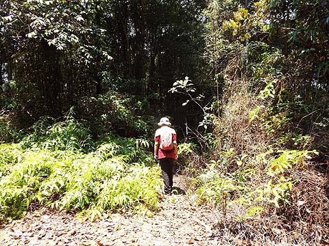
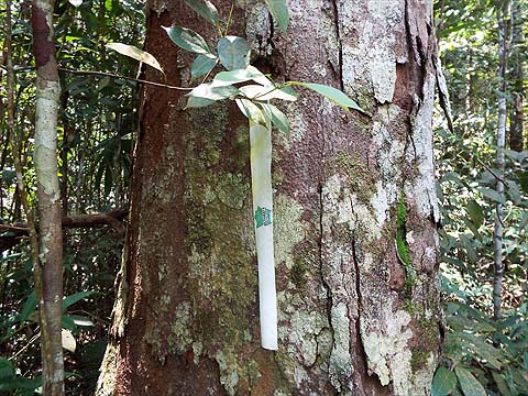
This path is one of many 'discovered' by the 'Ultimate Trails of Penang', apart from the occasional strip like this there were innumerable and vastly excessive numbers of small grey pieces of cloth stapled to trees, just why I have no idea. When there is no junction along the ridge path for at least 2 km, it would be impossible to get lost here unless one deliberately went left or right into the undergrowth. Soon we had a short dip to negotiate.
Having climbed back up we were faced with a longer descent. Two separate ropes were provided but Yuehong had no need of them.
Shortly after there was a blockage but just why it merited some of the dreaded red and whit plastic is quite beyond me. If participants in these events are unable to spot such obstructions and take appropriate avoiding action, then what are they doing here in the first place? Fortunately the rest of the ridge was totally clear and we could enjoy Penang hiking at its very best.
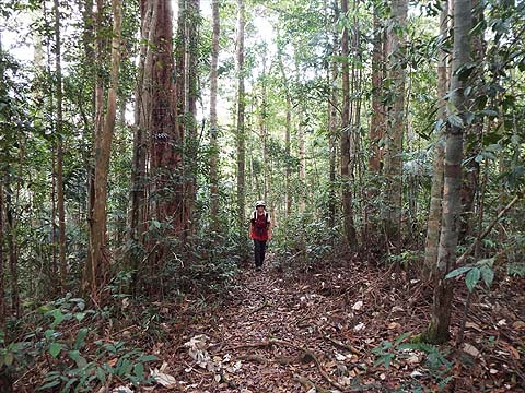
It's rare to find such an extended stretch of trail that is as near as flat as makes no difference and along the way we passed more Moniot stones.
This is the new location for rain gauge 29 (RG 29), about 1km south from where it used to be. If they had moved it much further it would have been very near RG 30. There were yet more Moniot stones, some idiot had desecrated the last one, the plastic ended up in my trouser pocket. Some of these so-called outdoor enthusiasts just don't deserve to have these places on their doorsteps.
The fallen yellow sign told me that we were reaching the junction with the path up from the Tiger Hill valley and for a while the invasive signage disappeared as we walked along a rather firmer path as it is used by farmers in the valley below.
It always takes longer than I expect but soon we were at the 5 way junction and it was time for our second break. Afterwards, we continued on the link path to the Balik Pulau to Air Itam road.
This was our third transit this visit and conditions along the path have got better each time. While it looks quite good when it's overcast, it's much better when the sun breaks through the canopy.
No one has yet attempted to mend the bridges, but a much needed chain saw had been taken to this fallen tree.
This tree had been sorted earlier and the bridges were definitely still not 'mountain bike friendly', what a shame!
Actually as long as this landslide is left, then I can't see them coming down here.
Yuehong is a bridge hopping expert now and, best of all, the major tree blockage at the bottom of the zig zag has been sorted by some public spirited people.
Two more dodgy bridges and we knew we were almost at the other end.
The sun came out which was perhaps a shade unfortunate as we had come down far enough for the temperature to rise again. We took it gently down the concrete road as we know that its angle of descent is not 'knee friendly'.
We took our third break at the temple below the col on the Balik Pulau - Air Itam road as there us a cool water tank filled from a hill stream there. By now we were passing the daily exercisers (all Chinese...) and we found the car park packed. The hike had taken around six hours including breaks and it was just the final warm up (hike #99) we needed for our upcoming National Park adventure which will be #100.
It's a great walk and as all of it is at a height of 250 metres or above, the temperatures are bearable throughout.
|