|
Penang Hills and Trails - Back Door to Penang
Hill Again |
|||||||||||||||||||||||||||||||||||||||||||||||||||||||||||||||||
|
This is one of a series of pages on walking the hills of
Penang, click here
for the index. This is a Grade 4 walk unsuitable for those without
experience of off-piste hiking. There are two sketch map at the bottom showing the route followed. Click here
for a list of the known PBA rain gauges.
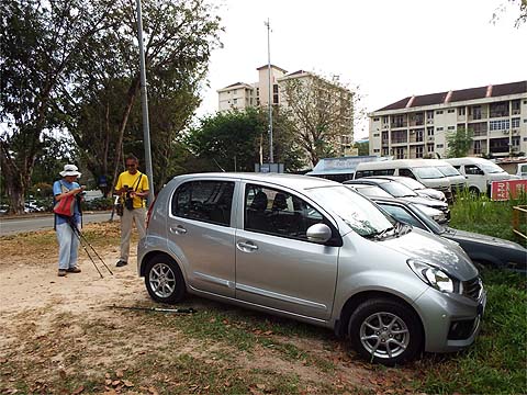
IMPORTANT By December 2023, the route from the Bayview Beach Hotel towards the Batu Ferringhi Reservoir past the 'Chin Farm' had been aggressively blocked by razor wire in the area where there is a gate by the water tank. There are also numerous signs stating "NO TRESPASSING - NOT A PUBLIC HIKING TRAIL" This will mean that there is no longer any access to / from any of these well known paths: 1. That to the Rimba at Teluk Bahang I do not know about current access through the main gate to the aqueduct above the former Holiday Inn. In November 2018, Peter van der Lans guided me through the new route connecting Penang Hill's Summit Road and the ridge running north-east from Western Hill. The route afterwards gained a degree of notoriety when a party of Christmas Day hikers used it as we had, but failed to make a turning (as described below) and continued down a ridge until they could go no further and found themselves 'trapped' in the jungle in the dark. At seemingly no risk of harm and with no one needing medical attention, they summoned the 'Bomba' (Fire and Rescue Service) to extract them, an exercise that would have been less fraught for all concerned if they had waited patiently till the morning. I was told a couple of weeks ago that some of their friends used my report to assist the rescuers but I have no way of verifying it. In my report. I said "Will Yuehong ever come this way? That will be her decision because although she could probably cope with the climbing, the short downhill sections at the end of what would already have been a long day might be more than her bad knee could cope with." Well, I was ordered to do the business and we waited until friend Nathan was available to join us which meant we could have cars available at both ends. We also chose a weekday at a time when there were likely to be fewer visitors to the main hill so we wouldn't have long to wait for a train down. With Nathan's car at Penang Hill Railway lower station, we were ready to leave the Bayview Beach Hotel just before 09.00, if anyone can catch me in such a pose at the start of a walk, I'll gladly pay to get the picture buried. I had made a mental note of my earlier intermediate timings so I would know how much remaining time we would have 'free' at any point. It was a little overcast and I was concerned that it might rain, but in the event it was a great day for hiking with some soft sunlight coming through the canopy from time to time. On the way, I got the other two to pose at the classic Batu Ferringhi Dam.
To save a little time, we took the short cut past Rain Gauge 16 (RG 16), it appears active but the lock has been broken. Had someone lost the key during a period out of use?
The path comes out at the beginning of the upper Fettes Aqueduct and along the way we could see the repairs necessitated by the Great Storm of November 2017.
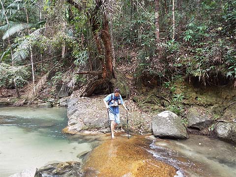
At the top dam, we ignored the red warning sign as everyone does and walked above the stream for a few minutes. The path continues some way beyond the unsignposted crossing. The large rock is slippery and extreme care is needed to ensure you don't get separated from your boots.
It's an idyllic spot but there was no time to waste once we had our footwear back on. As we started the climb, I noticed that at least one tree had been marked in a similar manner to those on the new trail.
As it was overcast, Yuehong and I put away our hats. If we hadn't been warmed up by the time we crossed the stream it wouldn't have mattered because today's route climbed almost constantly for what turned out to be the next 2 hours.
The climb eased slightly as we left the bottom of the valley and from time to time we had a short flat stretch.
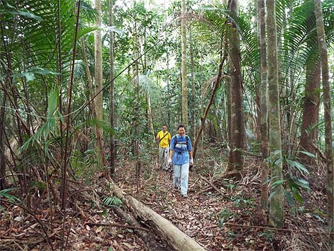
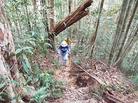
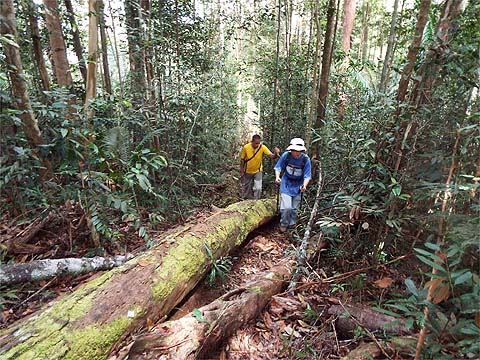
We needed to be nimble to get through the fallen trees.
I had a hint of our excellent progress when we got to Rain Gauge 20 (RG 20) in just ¾ of an hour. Above it is is probably the most stupid of all stupid signs on these paths. It's facing down the hill and is hence almost certain to be missed by those it is presumably intended for.
There were hints of sunshine and the hat went back on, my recollection had been that this was the steepest section and so it was.
It was indeed a relief when we got an occasional respite, it gave us a little bit of time to appreciate our surroundings.
One more big effort and we reached the first junction. The other path off to the north-east follows a ridge towards Rain Gauges 19, 18 and 17, it completes a lovely circuit above the upper Fettes Aqueduct.
Today it was just a brief water stop and indicated that the worst of the climb was over.
The great thing about the 'Western Hill junction' is that it is totally unexpected, it comes in the middle of a climb and there is no significant flat area around it as often happens. Continuing up is inadvisable, the military at Western Hill are unwelcoming and it is said that they now have CCTV to assist in the detection of those who ignore the warning signs.
We had come from the stream in exactly 2 hours, an extraordinary performance by Yuehong, as a guide Peter and I had taken a leisurely 2¾ hours back in November. The water bottle was now getting quite light as we turned left along the path which would take us to Rain Gauge 9 (RG 9) if we missed our trail off to the right mid way.
This is an old path, along the way are these rectangular markers (bottom left) which we call Moniot stones after Frenchman Jules Moniot, Surveyor-General of the Straits Settlements from 1855 to 1862, who was responsible for the first proper mapping of the island. Elsewhere some of these stones are also marked "M" which I have always assumed to be his initial and of course one of the roads on the main hill is named after him. There is a copy of his 1860 map in the National Archives, Singapore (search Google). I left Yuehong to sort out that mess of branches privately.
It's not quite all downhill but Yuehong was sensibly taking it very carefully as we passed the sixth Moniot stone, not far to go now.
This was my marker tree for the turn-off from my first visit, looking back towards where we had come from. Two months ago it was in mid air, now I guess it will soon be gone. The route was exactly as I recalled, markers everywhere. The only difference is that it has now seen rather more use and in places the markers were already almost superfluous.
Nathan went on ahead, the first part is tricky and steep, Yuehong wisely engaged reverse gear.
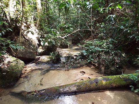
Nathan waited for us at the stream, compared to my first visit there was rather less water in it.
Yuehong found her way down, we poured my 'emergency water' into the main supply and refilled that container from the stream - in the event it wasn't needed. As soon as I mentioned the leeches we had found here last time, for some reason the other two shot off up the bank. The immediate climb was probably the most demanding of the day.
We had to pause when Yuehong spotted this bright red seed pod which cannot have been open very long. A quick search suggests it is Sterculia Quadrifida, popularly known as the Peanut Tree. It grows to 5-10 metres so this is a young one.
The climb eased briefly and we had a short descent before resuming upwards but overall it was getting less steep now.
The sun came through gaps in the canopy and I remembered ducking round the side of this tree from before, it had fallen right across the intended route.
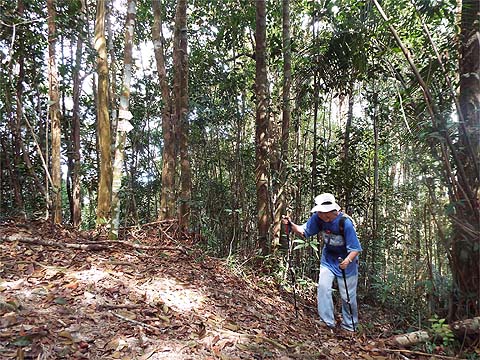
From hereabouts we were following a ridge in more or less a straight line and not surprisingly there were rather fewer markers.
On average, it was rather clearer than he pictures suggest, certainly it would have been impossible to have left what was now definitely a path without disappearing over the side of the ridge for the most part.
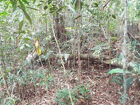
We came to a point where the markers branched right, Peter and I had missed this before and gone straight on - not that it mattered in the event. We had no 'on board mapping' on that occasion and only later was I able to see just where we were. When I mentioned that I was going to look for the 'short cut to Rain Gauge 7' I could see a couple of faces falling. I tried to explain the situation and that we had plenty of time to spare as it wasn't yet 14.00, yet for some reason they didn't seem in a hurry to continue just yet. Peter and I had got to this horizontal log only for me to reject turning left, after which we soon found the red paint markers to the right.
My reasons for not turning left were that the path was clearly less used than the one we had been on and that there were no markers on it. In fact there were a few but mostly on the wrong side of the tress for the way we were going. Quite soon we came to a junction. Of course, I knew now that Summit Road was to the right but from what I know the Christmas Day hikers definitely did not and must have ploughed straight on where I assume there were no markers. According to on line reports they were found at 5 27 17.9 N 100 15 39.6 E - Google Maps will show you where this is (even without the punctuation marks). Helpfully it told me it was 17 minutes drive from our home! If the co-ordinates are correct not only had they gone down the ridge but blundered off left from it.
Our path led downwards and there were indeed markers to be seen although for the first time in a while there were small branches across the track, I guess most people have been following the way Peter and I went down towards Tiger Hill.
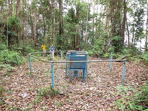
We brushed our way through the ferns and found ourselves at Rain Gauge 7 (RG 7). It was time to crack open the Tiger and even Yuehong had a sip. Since my only visit here two years ago, a proper datalogging system has been installed. Like that at the nearby Rain Gauge 6 (RG 6) on Summit Road which we passed later, this seems to have been a knee jerk reaction to the damage caused by the infamous Great Storm of November 2017. Even before that time, the authorities claimed that the system of rain gauges was actively monitoring rainfall "on a daily basis in Teluk Bahang", something which anyone who has read my reports knows to have been demonstrably a total nonsense. I haven't spent much time on the rain gauge trails in the last 15 months so I don't know whether others have had a death bed revival like these two.
We walked to the upper station and took the train down after which Nathan drove us back to the Bayview Beach Hotel to collect Mavis. We even had time for a shower before we went to dinner. Needless to say I was very proud of Yuehong, this is an exceptionally tough walk, Nathan described it as being both challenging and satisfying and I can't disagree with that. However, if you decide to give it a go, then make sure you are suitably fit and go properly prepared in every sense. As I have explained, it would take just one small mistake which if compounded could lead to near disaster. I have a set of 'template' maps of different parts of the island which I use for reports, but, in this rare case, for this hike I need to use two! I can't justify the time to produce a new combined one.
|