|
Penang Hills and Trails - Cheng Kon Sze Yet
Again |
|||||||||||||||||||||||||||||||||||||||||||
|
This is one of a series of pages on walking the hills of Penang, click here for the index. This is a Grade 2 walk. There is a sketch map at the bottom showing the route followed. Please visit my Penang buses page for information on accessing the starting point. We had paid a visit to Cheng Kon Sze (Cheng Ji Chan or 9 Emperors Temple) with Mike Gibby back in December If you've got here with a Google search and want to see the temple, click here for the earlier walk as in the end we took a short cut and consciously missed it. This was a 'bonus walk', it was our last full day in Penang and at best I would normally be kicked out to do my own thing while Yuehong tidied the flat up. However, she was so well organised that when I said I would go on a short walk up to Cheng Kon Sze on a route I had just gleaned off the web, she announced she would join me. Credit where credit is due, this is my source:
We parked Mavis off the main road and headed for the nearby turning with Pei Thong on the corner.
Left we went to follow the line of poles and then straight up at the three way junction.
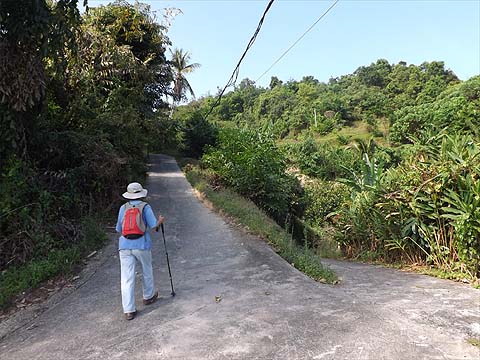
There was no problem at the next two junctions, the poles went left and so did we.
I'd made some notes and they said 'next junction, turn right' unfortunately this one was not mentioned in the original... It's a shame it wasn't part of the route because it was just about the most pleasant part, however, we only wasted about five minutes here. When I checked the original later, our friend had got a picture in the wrong place (see below).
We did get the best view of the Guan Yin monstrosity I have achieved, most of it being hidden by the vegetation. It was a hot hazy day and there was absolutely no temptation to photograph George Town in the distance or the abomination that it today's Paya Terubong.
So up we went, having started at 10.00 in mid-March, it was now very warm and we're no fans of vegetable (and flower) gardens in this fragile landscape.
Not so long ago, trees would have covered this area just as they did the Nanshan hill further along. The residents below paid for the uncontrolled farmers' folly in the great storm in November 2017, erecting the odd shrine won't appease the gods of the hills.
Now this is actually the 'turn right' junction shown in the report, no wonder I was confused by now! At the next house, the road continues almost out of sight to the left as correctly stated.
This hut sits proud on a small hill top surrounded by unused plots as it's currently the dry season. There are piles of fertiliser bags, something which shouldn't be needed in this quantity to sustain production. Goodness knows how much pesticide is also used. No state government in Penang has ever tried to control how the land is used for agriculture.
Next were more passion fruit and up ahead we could see the communication tower which is just below the road up from kek Lok Si and hence our effective initial destination.
There were no instructions for the next junction, I knew a right turn was coming but its picture showed a yellow sign. Nevertheless I looked right and found it went barely 100 metres.
So we went the other way and soon came to the junction we needed, the sign is a bog standard 'Private Property' one and hence safely ignored.
We were prepared for a complex junction ahead. It turned out that on the right was the access road to the tower which we needed to follow. There was another road down to the right a short distance which led to a birds' nest factory.
At last we were into an area which was properly tree covered and very soon we hit the road up from Kek Lok Si. We turned left.
We passed the large house with its plethora of trespass notices, security fence and cameras but it looked almost as unloved as ever. It was clear people were going in round the end of the fence, presumably to help themselves to the durians. Now, we had been to Cheng Kon Sze just 3 months ago and had business in town - my supply of Chinese cakes and biscuits to take back to the UK - so when I suggested a short cut left, Yuehong was very happy. This is a relatively new road, but properly engineered.
It ends at this 'modern property' which is just across the route of the 1200 steps. With scant regard for tradition, the path has been made much steeper on both sides to accommodate the road, the sort of thing rich people do without thinking.
Neither of us is really comfortable on long flights of steps down, we went down very gingerly. If someone had been above me, they would have seen me nursing my left knee as Yuehong was her right one.
I have to say that where it is not steep, the route is extraordinarily beautiful, basically it's full of small trees and bushes which have grown up among the neglected durian trees. We needed a break and while we rested, the bird song was extraordinary.
We just had to be patient as eventually a concrete path came across from this hut and this joined another which was running parallel to the steps. We took it with alacrity!
It swings to and fro, passing a couple of houses and is far less steep, the second pictures shows one of the places it crosses the steps.
It wasn't long before we were approaching the lower reaches and the United Hokkien Cemeteries. The lucky graves have a contractor who maintains them, many of the other will get their annual tidy up come the beginning of April ('Ching Ming').
Yuehong had suggested postponing the shopping to Wednesday but I vetoed that as I considered it was asking for trouble. When we got there, I was vindicated, the shop would be closed on Wednesday and Thursday to give the staff a rest after a very busy Chinese New Year. Next year, we'll allow a week! This was our last hike of the 'season', I have written some 75 reports and we have done a fair number of other hikes which for various reasons have not been reported. We have been out almost daily and while the hiking has largely been civilised as opposed to adventurous, we significantly added to our existing knowledge of Penang's byways. Thanks to having Mavis we have had probably the most satisfying Penang visit ever, we intend to repeat the investment next time too.
|