|
Penang Hills and Trails - Balik Pulau Explorer
9 |
|||||||||||||||||||||||||||||||||||||||||||||||||||||||||||
|
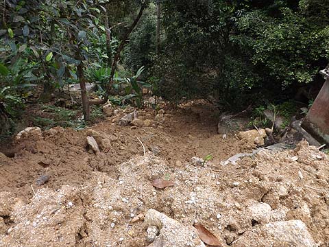
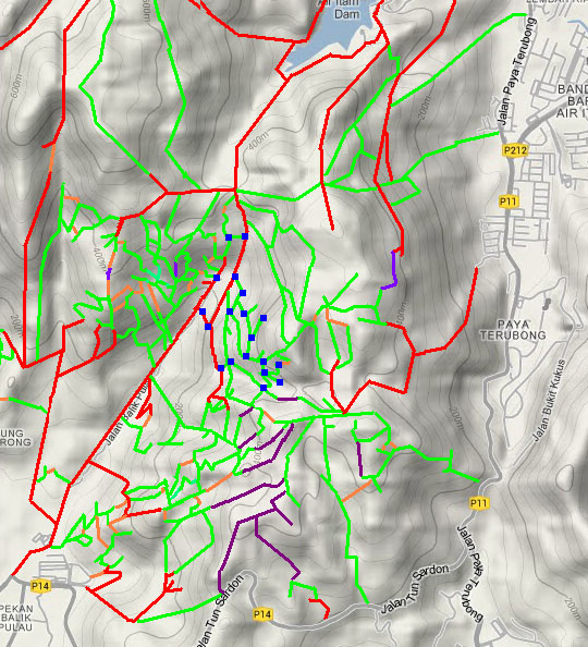
This is one of a series of pages on walking the hills of Penang, click here for the index. This is a Grade 2 walk. There is a sketch map at the bottom showing the route followed. Please visit my Penang buses page for information on accessing the starting point. A few days before, we had looked at the lower areas on the east side of the Balik Pulau valley nearer town. Today, we planned to set out from where the valley starts to climb towards Air Itam, with the car we could avoid the 30 minute walk (and the same back). We parked under a tree and immediately attracted the attention of the local dogs who were neither as noisy or aggressive as normal. One of them chose to guide us for the first part of the walk, pausing at times to make sure we hadn't got lost. I'm no fan of the meditation centres and hermitages which have sprung up across the island. Generally they make a real mess of their land and throw up high fences regardless of whether they will block traditional paths. The Appamadavihari Meditation Centre has carved out a huge section of what was perfectly good hillside and, as we had seen before from some distance, part of it has now collapsed in the recent heavy rains. It's standard practice in this area to build up banks of boulders as support for access but in this case the top one had fallen away. It wasn't practical to inspect close up owing to the privacy notices and the fact that someone in a big car was up there inspecting the damage.
It's an easy to follow route because of the electricity poles, just remember to keep right here where the road becomes a path. Yuehong had her eye on this durian of course, but it was nothing like ready.
My sketch map told me we had to turn right when we hit the main road and go a short way down. Soon we could see signs of the force of the water that had come down after the recent storms. There were many trees down and large boulders had been washed down too. I confess that I wasn't really paying attention when we turned left...
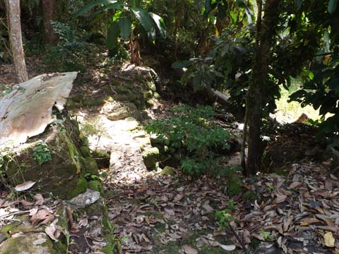
Our canine friend left us here, only the Burmese can make a mess like this and here was a house I did not remember.
I knew we were on the wrong route when I saw that afterwards we were on a path and not a road. Never mind, we were not in a hurry and were in exploring mode. We came to a junction and kept right because I wanted to establish the connection with our known route up somewhere ahead. Very soon I could see the 'right road' below us, we ignored the small path on the left.
Round the bend was a, by now, not unexpected junction. So, curious about what lay above we turned back and as always routes look different according to the direction of travel.
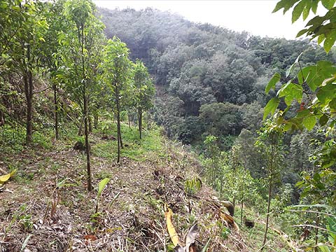
We now went up left and met yet another junction. I went left and the second picture is the view looking back, note the landslide in the background. This path went to a small hut and continued, we know not where, that's for another day. We headed up towards the landslide.
As it happens there was a zig-zag and we went some way above it, coming eventually to another junction. Now this was a very short distance from our regular trail so this time we did go up the other path.
This was a flat one, it started promisingly but soon got a little overgrown, ultimately finishing at the estate border. Beyond were more durians but clearly not as well maintained as these. We returned to the main path, noting this view of what our Buddhist 'friends' have achieved, making a hell on earth to get Nirvana.
We don't need a mansion to lead a healthy lifestyle, it's unbelievably peaceful up here alone in the estate. We noted one new path to the left which currently extends just 100 metres.
The power lines finish at a hut up this side turning, behind which are the remains of a former house. "Wouldn't it be interesting," I said "if there was a path onwards>" so I went and looked for one. Down the steps was a small streambed and just below a flat area with an inviting gap.
Through I went and those were steps and a path. I went back to get Yuehong who was eyeing two durians, but they weren't ready either. I dragged her away and almost immediately we could see a lightly used concrete path below us. This made for a natural refreshment stop. It was actually a cross roads, I checked out the horizontal path and found it ended at a very small orchard after about 5 minutes.. It was time to climb.
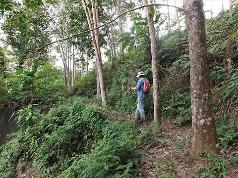
We'd only ever been in this area once and that nearly 3 years ago and there was little of significance until the formal path finished and we could see rubber ahead. For me, it confirmed we had been here before. There was no sign of a way out at the end of the lowest rubber terrace and if we went up, we would only get to a higher part of the main path.
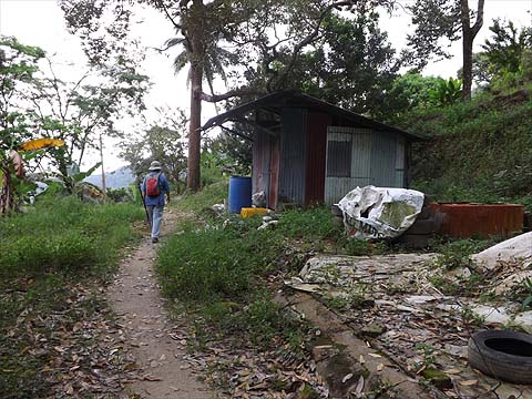
We'd been going for 2½ hours and as we had been out hiking 11 days out of the last 12, conserving energy and going down made a lot of sense. The lower parts of this durian estate are attractive if not well maintained and the hut is at the junction for the 'Forest Ang Trail' up to Nanshan.
I'm not sure Yuehong knew quite where she was but she picked up my relaxed mood and packed away her sticks. This was another streambed which had been overfull recently.
If there was a glimmer of recognition when we passed the hut, I missed it and when I indicated to go down this minor track instead of staying on the wider concrete road, my judgement was politely questioned with a "Are you sure?".
Of course, I was, round the corner is another junction and that path comes out on another, newer, concrete road. This was a case of one zig-zag too many, the upper bank had collapsed in the rains, the road must have been covered by the slide at one stage. Much soil and stones had been carried across the lowest part. This is a shorter and wider version of the road we had come down from, the builders had obviously taken too much of a 'short cut' in every sense.
We were back at the car soon after and there to greet us was our guide dog. He went hungry, we don't carry food on our shorter hikes like this, I don't think anything we have done this time round has gone far beyond 4 hours and this was much less. Our fitness is improving and if the rains continue to stay away then maybe we shall get more adventurous. So far we have carefully avoided the higher areas of the island which have been cloud covered every day. The Gods cannot have been totally pleased with us as the Magic Tiger Tree in Sungai Pinang was unusually closed up. However, we could still get our regular early dinner round the corner.
|