|
Penang Hills and Trails - Bukit Batu Itam Loop |
|||||||||||||||||||||||||||||||
|
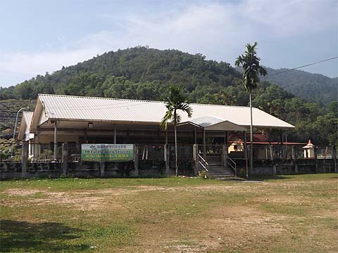
This is one of a series of pages on walking the hills of Penang, click here for the index. This is a shorter than average Grade 4 walk unsuitable for those without experience of off-piste hiking. There is a sketch map at the bottom showing the route followed. Click here for a list of the known PBA rain gauges. Please visit my Penang buses page for information on accessing the starting point. Yuehong and I had twice walked the ridge west of Bukit Batu Itam - once on our way south, the Bukit Batu Itam Challenge and again as part of the National Park Circuit. We had noted a small path running north which, were it to go through, would go directly to Teluk Bahang. A path doing just that is shown on some of my older maps but no reports of its current status appear on the web. Now I am severely prejudiced against going down hill on dubious paths as they are generally a recipe for disaster. Instead I would start up the valley to the west of the United Hokkien Cemetery and live on my wits. I took the official road to the UHC from just before the National Park and when I came to the 'Garden Centre' turned right. As always the trespass notice can be ignored and round the corner is the small Christian Chinese section, where a family were doing the business. Rather further on a couple of uneducated locals were out trying to catch birds which would be kept as pets no doubt.
Where the road ends is a small shelter for what I assume are (Malaysian Indian) milking cows. Just before, a concrete trail runs down to a stream and I took this.
The path is currently being upgraded and as I would have expected, it becomes less and less distinct as it comes towards the top of the orchard.
Basically, I think the old path would have continued straight up (there is a survey stone in the final picture just above) but the interface between the estate and the forest looked totally impenetrable. Perhaps, I should have tried harder... Looking at the map again later, there seem to be two not very pronounced ridge running up, I found it much clearer to the left which probably settled my fate for the day. I followed a stream bed up a short way and then fought my way up to what seemed to be a ridge. Beyond the boulder it was relatively open under the trees.
As I climbed steadily, I could see the ridge with the path leading to RG 27 and RG 26 on the top of Bukit Batu Itam. To my right there was some brightness because my ledge had a level section. This part seemed to carry a long disused path, but later I decided it was probably an illusion.
As always, parts were no problem and others had ferns. Some patches were small enough to blast straight through, others had to be skirted left or right. Once again at one stage I had to extricate myself by walking on a convenient fallen tree. Clumps of fallen trees were mercifully rare.
There were several false summits where I could see daylight through the trees only to find more climbing was need. Eventually, I came to what seemed to be the mother and father of all fern patches, it extended left and right for as far as I could see and ahead, well you get the idea from the picture. I had no choice, I wasn't going back down and I just ploughed on in. I'm told that British soldiers in the then Malaya, would take it in turns to fall on the ferns to force a way through, that was something I would only do accidentally.
Three minutes later, the ferns parted and I was on a well used trail. As soon as I saw the hash paper as well as the plastic markers I knew I was on the normal path from the cemetery and four minutes later I was at the junction just before the campsite and RG 26. It was time to relax and reflect.
I could have gone back the long way, it would be a much better walk, but after several hard days, I needed a rest. I was off to Pulau Jerejak early next morning with Mike Gibby so I took the easy way out and chose to go down past RG 27. It was just as well, as in the excitement I had left my walking stick where I had emerged. A couple of hours later I left it again after a long drink near where the buses turn round by the National Park. It could just have been senior moments, but I think it more likely that I had been enjoying my freedom too much. This was not a walk I would inflict on myself again or anyone else. My basic question remained unanswered and I am glad I shall not have any opportunity to have another attempt here before we go home. It seems that the old trails here will remain 'lost' until the National Park decides to open them up as a matter of policy, from what I have seen there has been a conscious (and understandable) decision to leave parts of it undisturbed. Certainly at no point did I see any indication of the park boundary.
|